The original first volume in the series, Total Fallout included
several tables that listed fallout deposition values on a county-by-county
basis. Unfortunately, due to page limitations, it was not possible to include
the lower fallout values. Though some lower values were reported (i.e. Cowlitz
WA with 0.43 uCi/sq meter from the Buster-Jangle series) most cutoffs were
in the double-digit microCurie range.
The second edition of this series addressed this limitation by
segregating the fallout values into two volumes--Eastern and Western U.S. As
a result, the tables found in these volumes include county fallout values as
low as 800 nanoCuries (0.8 microCuries.) The states included in Volume III
Eastern U.S. include: Alabama, Arkansas, Connecticutt, District of Columbia,
Delaware, Florida, Georgia, Illinois, Indiana, Kentucky, Louisiana, Massachusetts,
Maryland, Maine, Michigan, Mississippi, North Carolina, New Hampshire, New
Jersey, New York, Ohio, Pennsylvania, Rhode Island, South Carolina, Tennessee,
Virginia, Vermont, Wisconsin and Washington.
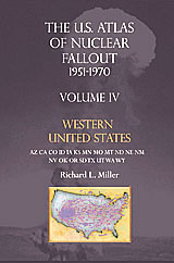
The states included in Volume IV: Western U.S. include: Arizona,
California, Colorado, Idaho, Iowa, Kansas, Minnesota, Missouri, Montana, North
Dakota, Nebraska, New Mexico, Nevada, Oklahoma, Oregon, South Dakota, Texas,
Utah, Washington and Wyoming.
Those wanting even more precision in total fallout estimates,
should refer to the series Nuclear Fallout from the Nevada Test Site 1951-1970.
The data, based on individual fallout days, include values as low as 14 nanoCuries/square
meter.
You can find the U.S. Atlas of Nuclear Fallout at Amazon.com
by visiting these
booksellers.