|
Figure 2: Aerial of Area 16--site of proposed
Divine Strake shot
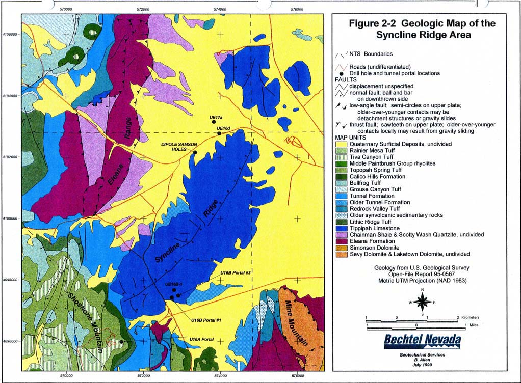
The blue area in the map below represents Tippepah limestone.
Documents from an earlier test (shot Hupmobile, 1968) suggest the presence
of a spring in the general area of the Strake GZ. Current documents provided
by the DOE do not show the presence of the spring.
|